GEOLIT - Lithosphere Geosciences Research Group
Since prehistory, man has sought in nature for various materials that would allow improvements in his living conditions, from the simple act of hunting (minerals and cutting rocks) to his cultural-religious rituals (powders of certain minerals used to paint the body). Currently, it is no different. It is impossible to imagine a society, as we know it, without dependence on mineral commodities. If we look around us, everything has some degree of relationship with mineral resources, directly or indirectly. Civil construction, technology, pharmaceuticals and agriculture, are some examples of sectors that use mineral resources. What would your life be like without the internet, electricity, industrialized products, large-scale agriculture, and even drinking water? Imagine even that, with the world population growth, the demand for all mineral inputs also grows. Also, the high pace of consumption means that industrialized products, especially electronic products, have an increasingly shorter life span and are replaced more quickly.
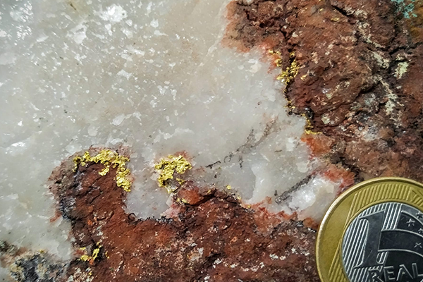
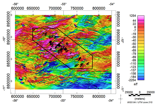
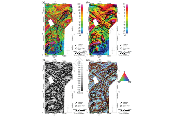
This scenario provides an increasingly intense search for mineral resources and understanding the natural processes involved in their genesis, considering the most diverse mineral deposits and systems. Metallogenesis aims to understand natural processes responsible for forming mineral deposits (e.g. geological, geochemical, biological and atmospheric, hydrographic), especially the metallic ones. This understanding goes from the source of a specific metal or element to the processes involved in its transport and concentration in the earth’s crust. Also, it is necessary to know phenomena related to their accumulation (deposition, precipitation, formation). Understanding these processes occurs from describing deposits characteristics and/or mineral occurrences. From then on, it is possible to relate the products (textures, structures, shapes, geometries, mineral associations) with the respective magmatic, sedimentary, metamorphic and hydrothermal processes. Metallogenesis studies use petrographic, geochemical, isotopic, geochronological, geophysical, remote sensing tools and others.
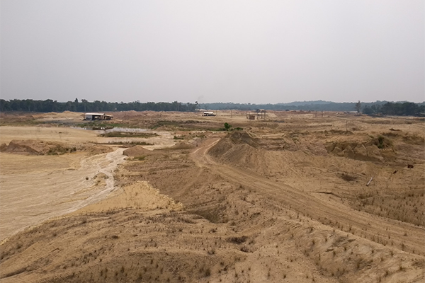
It is up to the mineral exploration to discover new mineral deposits. It uses techniques and tools to predict the existence of in-depth mineralized bodies, initially inaccessible to us. These techniques include satellite imaging, geophysics, geological mapping, mineral chemistry, more recently, machine learning. With these approaches, GEOLIT has sought to understand processes related to mineral deposits genesis in several Brazilian mineral provinces such as Alta Floresta, Carajás and Tapajós.
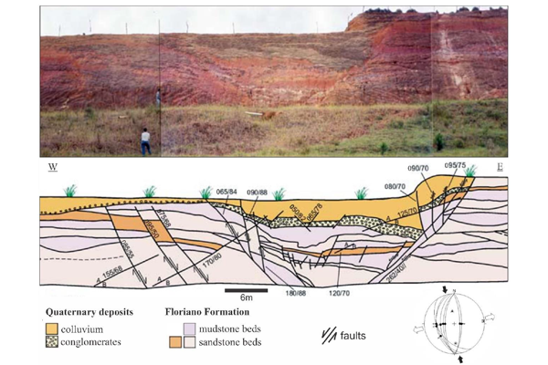
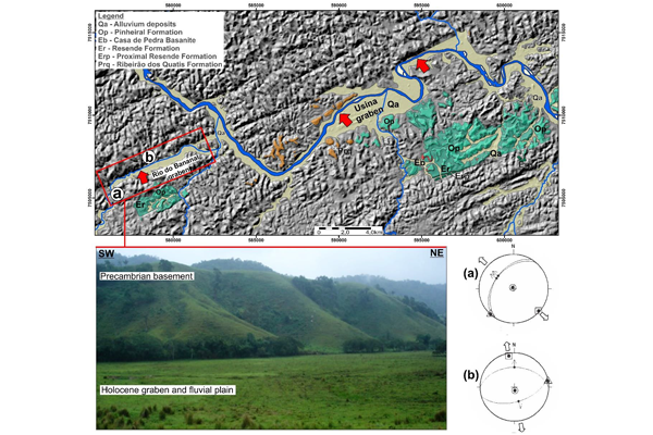
Neotectonics is the term that encompasses the set of processes related to the movement and deformation of the Earth’s crust from the Neogen to the present day (last 23.03 million years). The Neotectonics study is a fundamental aspect in seismically active areas and geohazard assessment – earthquakes, volcanism, landslides and tsunamis. It is also important in prospecting energetic resources (migration and accumulation of oil and gas) and in understanding the evolution of the modern landscape, such as mountain ranges, sedimentary basins and courses of small and large rivers. It is also from recent and current tectonic processes that geoscientists can deduce and understand the tectonic processes of the Earth’s deep past and the rocky planets of our Solar System.
In Brazil, several groups study Neotectonics. Their works aims at large engineering enterprises, as hydroelectric, mining and nuclear plants; seismological studies focus on
crustal dynamics in Brazil, and on the evolution of Brazilian geomorphology and large rivers. At GEOLIT, Neotectonics studies are developed to understand the landscape of southeastern Brazil, emphasising the evolution of the Continental Rift of Southeastern Brazil, including the Serra do Mar and Mantiqueira ridges, as well as the evolution of the Paraíba do Sul and Tietê rivers. Neotectonic investigations are also being developed on the Continental Shelf in southeastern Brazil, with a focus on its effects on underwater morphology and on the development of potential hydrocarbon reservoirs in the Santos basin.
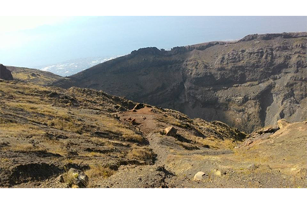
Volcanism is the most visual expression that the Earth is a dynamic, almost living environment. These great monuments of nature are part of the history of humanity and their myths. Volcanic eruptions can bring losses but also rebirth. Their products carry highly nutritious compounds and promote rapid recovery of the flora and, consequently, of the local fauna (see the surroundings of volcanoes such as Etna, in Italy, and Kilauea, in Hawaii). Likewise, volcanism promotes geological hazards with Plinian explosions, lava flows and lahars, but the potential for geotourism and geothermal exploration.
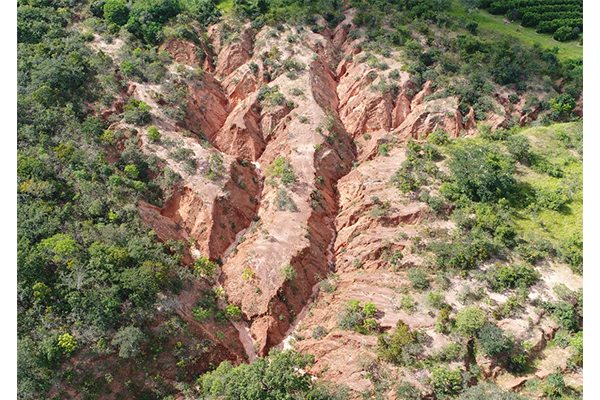
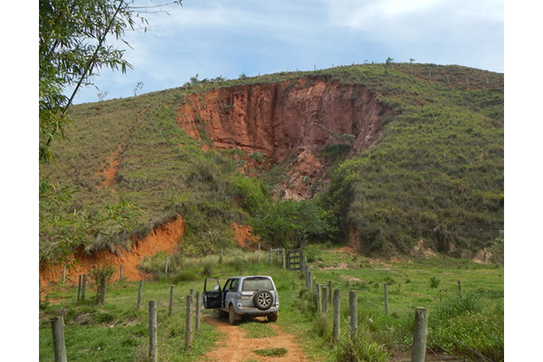
When we talk about geological hazards, one usually thinks of massive events like earthquakes, volcanism, tsunamis and avalanches. However, on a daily basis, we can see events of smaller scales, such as erosions, gullies and landslides. A simple hole in the street is still a geohazard since it was caused by a deterioration of the ground under the asphalt, which can cause damage and accidents.
At GEOLIT, we work with different geohazard scales, from assessing the causes and evolution of erosive environments to monitoring active volcanoes. These works include using cutting-edge technologies, such as drones, adapted geophysical equipment and their development, application of artificial intelligence, including Machine and Deep Learning techniques, in addition to evaluating public and private actions on how to mitigate material losses and, above all, of lives.
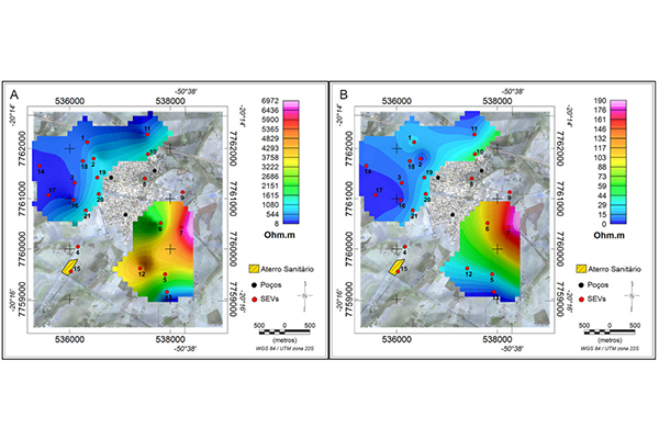
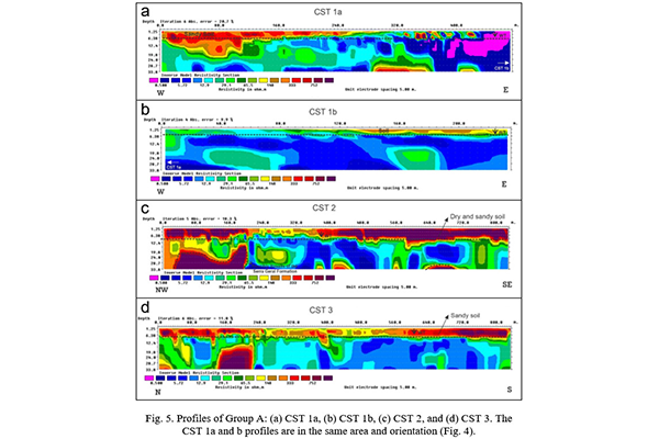
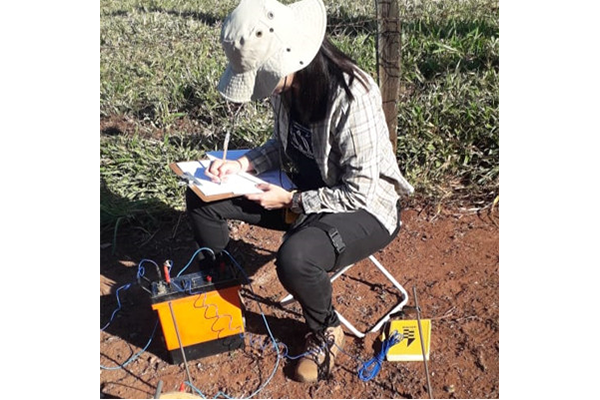
The need to preserve the environment is indisputable. Natural resources are a necessity, but they must be exploited responsibly and, above all, sustainability. The knowledge of areas vulnerable to pollutants concentration is essential for the growth of wages in cities. Pollution of soil and water resources are usual in city areas. Using hydrogeological and geophysical tools, we can identify them for immediate remediation.
The GEOLIT group assess, directly and indirectly, areas potentially susceptible to polluting agents, whether they are of natural or anthropic origin. Using geophysical tools, such as the geoelectric method and remote sensing, in addition to the recognition of features and properties of rocks in a given area, GEOLIT researchers seek to trace the best actions for the recognition and containment of damage to the environment.
© All Right Reserved 2021 GEOLIT